

Blue Ridge Parkway With Kids: Best Stops, Hikes & Family Tips
Plan the Blue Ridge Parkway with kids using mileposts: kid-tested hikes, Junior Ranger stops, and 2026 logistics for gas, food, and offline maps.
On this page
Blue Ridge Parkway With Kids: A Family Road Trip Guide
Last updated July 2026, this guide breaks the Blue Ridge Parkway with kids into short, milepost-anchored stops instead of one long drive. You'll find kid-tested hikes stretching from Virginia to North Carolina, the Junior Ranger program, and the logistics that keep a mountain road trip manageable with a car full of kids. Expect a milepost cheat sheet, not a mile-by-mile marathon.
Free guide: Stress-Free Flying with Kids
The pre-flight checklist, carry-on packing list, and in-flight survival plan we use on every family trip — from toddlers to teens.
Why the Blue Ridge Parkway Is a Family Road Trip, Not a Straight Drive
The Blue Ridge Parkway runs 469 miles with no traffic lights, no billboards, and a 45 mph speed limit for its entire length. That pace rewards families who plan short stops instead of trying to drive the whole road in one trip. Three sections work well for kids: the quieter Virginia stretch near mileposts 0-217, the Boone and Blowing Rock cluster around mileposts 292-305, and the Asheville area near mileposts 355-390. Each section also anchors a Junior Ranger stop, so kids can work toward a badge as you go rather than in one long sitting.
- Virginia stretch (roughly MP 0-217): fewer crowds, includes Fallingwater Cascades and Gully Creek Trail
- Boone / Blowing Rock stretch (roughly MP 292-305): Price Lake and Rough Ridge in one manageable cluster
- Asheville stretch (roughly MP 355-390): Folk Art Center, the main Visitor Center, and easy access to city hotels
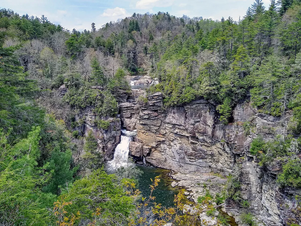
Essential Logistics: Reading Mileposts, Gas, and Offline Maps
Every stop on the Parkway is described by its milepost, a small concrete marker planted roughly every mile. Mileposts count up from 0 near Rockfish Gap, Virginia, to 469 near Cherokee, North Carolina, so a higher number means you're farther south and west. Plan your fuel and food around that number system, because the Parkway itself sells almost no gas or groceries directly on the route.
- Fill the tank before entering the Parkway, and again in a gateway town such as Waynesboro, Roanoke, Blowing Rock, or Asheville
- Cell and GPS signal cut out repeatedly along the ridge; don't rely on live rerouting
- Download offline maps (Google Maps or the NPS app) before you lose signal
- Pick up a free paper Milepost map at any visitor center as a backup
- Check the National Park Service road closure map at nps.gov/blri before you leave; sections close for weather and maintenance year-round
Best Blue Ridge Parkway Hikes for Kids by Milepost
These six trails cover the range families need: flat lakeside walks, short steep viewpoints, and one strenuous creek-crossing loop for older kids. Use the milepost column to slot each hike into whichever section of the Parkway you're driving that day.
The recommended 30-50 daily miles depend on hike selection. A strenuous trail like Gully Creek—with 10 creek crossings and 780 feet of elevation gain—consumes the day's entire budget, while Price Lake's flat 2.2-mile loop preserves capacity for multiple additional stops and Junior Ranger time.
| Milepost | Trail | Distance | Difficulty | Best For |
|---|---|---|---|---|
| MP 83.1 | Fallingwater Cascades Trail | 1.4 miles round trip, about 364 ft of elevation change | Easy-moderate | Kids who can hike 45-60 minutes |
| MP 217.5 | Gully Creek Trail | 2-mile loop, roughly 780 ft of descent and ascent, 10+ creek crossings | Strenuous | Older kids, or younger kids in a carrier |
| MP 297 | Price Lake Loop | 2.2 miles, flat | Easy | Toddlers and strollers |
| MP 302.8 | Rough Ridge Lookout | 0.3 miles to the boardwalk viewpoint | Short but steep | Views and photos |
| MP 355.4 | Mount Mitchell summit path | Paved path from the parking area to the summit, the highest point east of the Mississippi | Easy walk, high elevation | Families wanting a big payoff for little effort |
| MP 418.8 | Graveyard Fields | Waterfall loop, with wild blueberries in late summer | Moderate | Waterfall fans |
Best Non-Hiking Stops for Families
Not every stop needs boots. These three mileposts give kids a break from the car without a real hike, and one of them is where the Junior Ranger program actually starts.
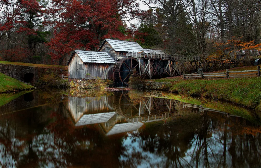
- Mabry Mill (MP 176): a water-powered gristmill with demonstrations and buckwheat cakes at the on-site restaurant
- Folk Art Center (MP 382): indoor crafts and demonstrations, plus air conditioning for a break from the heat
- Blue Ridge Parkway Visitor Center (MP 384): pick up the free Junior Ranger booklet here and start the badge activities
Planning Your Itinerary: How Many Mileposts Per Day
If hiking is part of the plan, cap each day at roughly 30-50 miles of Parkway driving. That leaves room for stops, snack breaks, and the unbuckle-and-re-buckle time a 45 mph road demands. Between Rough Ridge (MP 302.8) and Mount Mitchell (MP 355.4), budget around 90 minutes of driving, based on family trip reports; add more if you stop for photos. Asheville makes a practical overnight base near the southern stops, and pairing a Parkway day with walking Asheville's compact downtown the next day breaks up the driving.
- Virginia stretch day: Fallingwater Cascades, then a gateway-town overnight
- Boone / Blowing Rock day: Price Lake in the morning, Rough Ridge in the afternoon
- Asheville day: Folk Art Center, the Visitor Center for Junior Ranger sign-up, then an overnight in the city
Driving the Parkway From Atlanta
Families driving north from Georgia typically stage the trip over two or three days, since the Parkway itself moves slowly once you arrive. Break up the drive north with a stop at outdoor adventures around Atlanta, or add a day at Stone Mountain Park before you leave Georgia. A slower southern approach can route through Callaway Gardens or add a Chattanooga stopover on the way. Families looking for one last big outing before the Parkway's quieter pace also build in Six Flags Over Georgia or Atlanta-area water parks.
The two- to three-day journey north from Georgia provides critical prep time. Gas, groceries, and reliable cell service are accessible only in gateway towns like Roanoke and Asheville; once on the ridge, errands take longer and signal cuts out repeatedly. Complete fueling and supplies during the approach stages.
Nearby Detours and Other Southeast Family Trips
The Parkway pairs naturally with other Southeast stops families already have on a list. From the Asheville end, Chimney Rock's hiking trail and Gatlinburg and the Smoky Mountains both extend the trip west. Farther afield, road-trip families also build multi-stop itineraries around the U.S. Space and Rocket Center in Huntsville, Columbia, South Carolina, Myrtle Beach, or Mammoth Cave National Park in Kentucky. For a wider view of how these pieces fit together, start with the Southeast road trip planning guide.
Mistakes to Avoid on the Blue Ridge Parkway With Kids
A few planning mistakes account for most rough Parkway days with kids. Fix these before you leave home, not after you're on the road.
- Overestimating drive times: the 45 mph speed limit is enforced for the entire 469 miles, so mileage adds up slower than a highway
- Forgetting layers: temperatures at higher-elevation stops like Mount Mitchell run noticeably cooler than the gateway towns below
- Skipping the closure map: check nps.gov/blri before departure, since sections close for weather and maintenance
- Planning a hike sight unseen: match trail difficulty to your kids using the milepost table above before you commit the day to it
What to Pack Before You Enter the Parkway
Pack the car before you climb onto the Blue Ridge Parkway, because errands take longer once you are on the ridge. Gas, groceries, and reliable cell service are easier in gateway towns such as Waynesboro, Roanoke, Blowing Rock, Boone, Asheville, and Cherokee.
A small day bag prevents most family stops from turning into full unpacking sessions. Keep it within reach, especially around longer gaps between visitor centers and picnic areas.
- Bring filled water bottles, lunch, and extra snacks before entering the Parkway.
- Pack rain jackets or fleece layers for Mount Mitchell, Rough Ridge, and other higher stops.
- Download offline maps and save the NPS road closure page before signal drops.
- Carry a paper map, basic first-aid kit, wipes, and a spare trash bag.
Use staffed stops like the Blue Ridge Parkway Visitor Center at MP 384 for bathrooms, maps, and Junior Ranger help. Do not count on every overlook having restrooms or supplies.
For trip-planning details, see Blue Ridge Parkway — National Park Service.
Further reading: Atlanta on Wikivoyage · Atlanta on Wikipedia
Frequently Asked Questions
What is the best section of the Blue Ridge Parkway for kids?
The Boone and Blowing Rock cluster near mileposts 292-305 and the Asheville stretch near mileposts 355-390 both work well. Both keep several kid-friendly stops close together, so families skip long stretches of driving between them.
Is there gas on the Blue Ridge Parkway?
No, fuel and food are not reliably available directly on the Parkway route. Fill the tank before you enter, and again in a gateway town such as Waynesboro, Roanoke, Blowing Rock, or Asheville.
Will your phone work on the Blue Ridge Parkway?
Cell and GPS coverage cut out repeatedly along the ridge. Download offline maps before you leave signal, and pick up a free paper Milepost map at any visitor center as a backup.
How many miles should you plan to drive per day with kids?
Cap driving at roughly 30-50 miles per day if hiking is part of the plan. That pace leaves room for stops, snack breaks, and the 45 mph speed limit.
What is the Junior Ranger program on the Blue Ridge Parkway?
Pick up the free Junior Ranger booklet at the Blue Ridge Parkway Visitor Center (MP 384). Kids complete the activities inside to earn a badge.
Which Blue Ridge Parkway hike is best for toddlers?
Price Lake Loop at MP 297 is the flattest option on this list, a 2.2-mile walk that works well with a stroller.
Free guide: Stress-Free Flying with Kids
The pre-flight checklist, carry-on packing list, and in-flight survival plan we use on every family trip — from toddlers to teens.
You might also like



Continue reading
More guides you'll find useful


